MUNICIPAL WATER SUPPLY
There are no direct withdrawals of water from Chartiers Creek or its tributaries for municipal water supplies in the Lower Chartiers Watershed. However, water from Chartiers Creek enters the Ohio River at McKees Rocks. There are municipal water authorities using surface waters from the Ohio River downstream of McKees Rocks. West View Water Authority draws water from the north side of Davis Island. Since drainage from Chartiers Creek hugs the left bank of the Ohio River, Chartiers Creek does not impact West View's water supply. However, Robinson Township Water Authority does draw water from the left bank side of the Ohio River, approximately 6 miles downstream from McKees Rocks. The potential concern is for acid mine drainage, but the authority states that historically such drainage has not been a problem for water treatment.
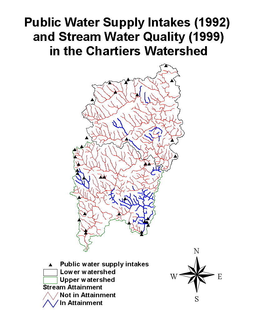
Another possible impact of stream quality on public water supplies is through groundwater and public wells. Stream water can migrate into groundwater, depending upon geologic conditions. The map below shows the locations of these public water supply intakes (Pennsylvania Department of Environmental Protection, 1996), defined as spring or seep locations. We cannot verify whether these are currently active water supplies or their volumes of supply. The map notes whether a stream is in compliance with the state's Clean Streams Act; i.e., is in "Attainment." While there are several intake points along streams that are in attainment, there are many which are not. Intake points adjacent to non-attainment streams DO NOT imply these water supplies are at risk. Risk would depend entirely on whether there are pathways from streams to these underground supplies. Note that the majority of intake points are located at headwaters of streams.