Mystery of the Misplaced GPS Tracks Solved
The original GPS tracks of my sailing from July 8 and August 9, 2009 had a mysterious anomaly. The tracks are slightly misplaced on the satellite map. That is most obvious is in portions when my boat, reportedly, sails over land.
My son Jonathan was home for a few days on a pass from his army base in Texas. He was looking over my shoulder as I showed him the problem in a GPS track of a run I'd just completed. I'd run over some of the city's bridges. You wouldn't know that from the GPS tracks. It looked like I'd run over the water. My path, for example, passed perhaps 100 feet to the West of the Fort Pitt Bridge.
That was Jonathan's first clue. "Look--notice how your path over the river looks arched, like the arch of the bridge seen slightly side on!"
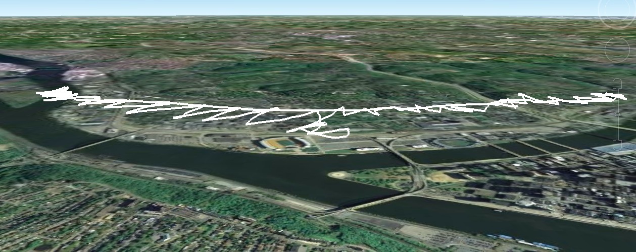
Sure enough, with just a little more fiddling, the problem was solved. I had been using Google Earth to create plots from the GPS data. Google Earth takes the altitude information in the GPS data very seriously. Unfortunately, whatever altitude corrections are made to the maps matches poorly with the altitude data from my GPS receiver.
The outcome is that Google Earth plots the track as hovering high above the river. The track looks more like that of a helicopter flying over the river. That can be seen clearly in the side on view of the August 29, 2009, track.(Click for larger view.)
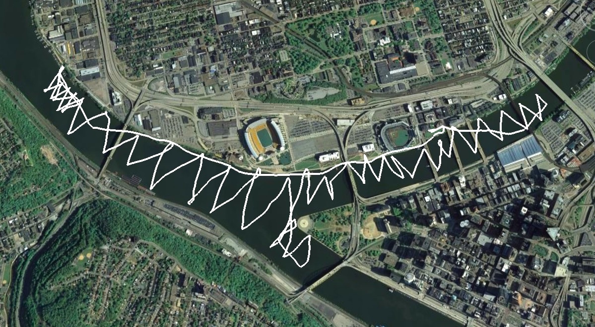
The plots I created earlier used an overhead view. That overhead view did not eliminate the parallax error resulting from the track floating high above the rivers. That led to the shifting of the tracks. You can see this if we compare two images.
First, here's the accurate plot of the August 29, 2009, sail on the satellite map. (Click here for a larger version.)
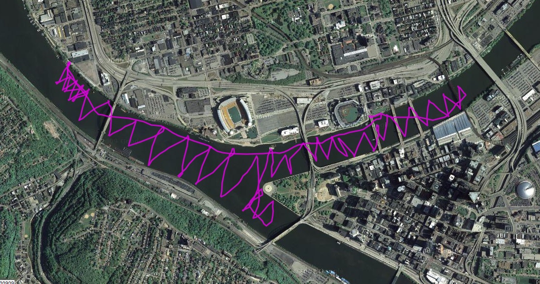
Note that the track only goes one loop past the railway bridge on the Allegheny at the Convention Center, in the top right of the map. Also the track does not pass over land. Both match with what actually happened when I was sailing.
Second, here is the image from Google Earth. (Click here for a larger version.)
Notice now that the track crosses onto the shore in places on the Northern bank of the Allegheny; and there are two loops upstream of the rail bridge. These, and other mislocations, are parallax effects arising from viewpoint that is shifted to the East and South. (Ignore one little loop on the bank, where I walked a few hundred feet along it after docking, carrying the GPS receiver with me.)
John D. Norton
Back to main