These charts show the "sailing line," which is the approximate centerline of the navigation channel. Here is where you should expect barges to navigate.
Maps from U. S. Army Corps of Engineers website http://www.lrp.usace.army.mil/nav/nav.htm#charts
Allegheny River
Monongahela River
Ohio River
Map legend
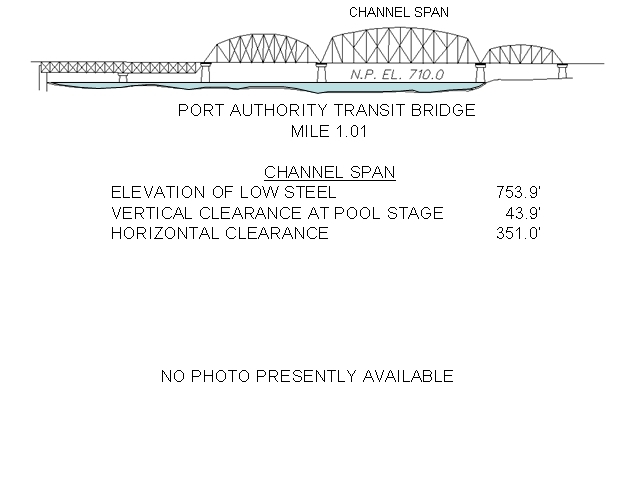
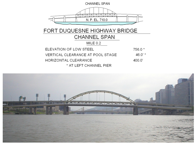
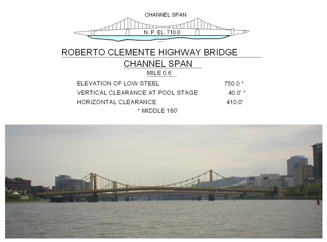
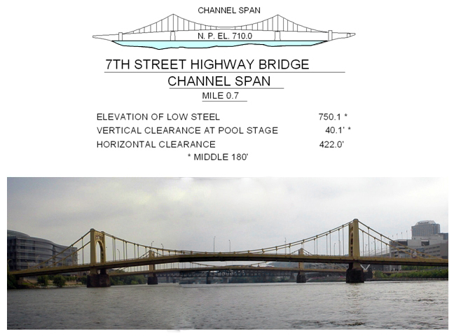
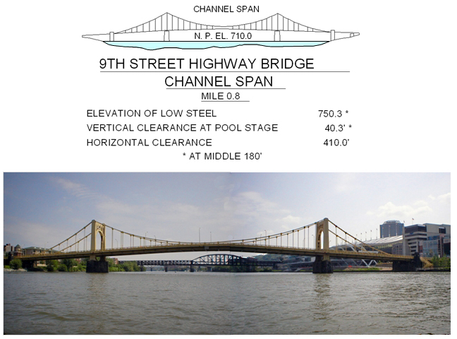
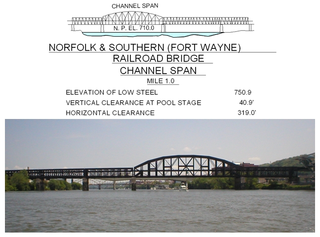
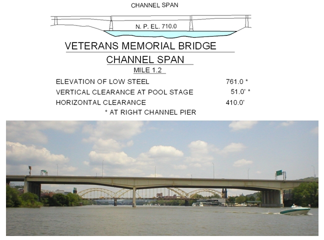
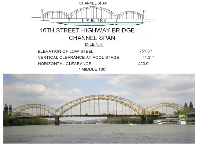
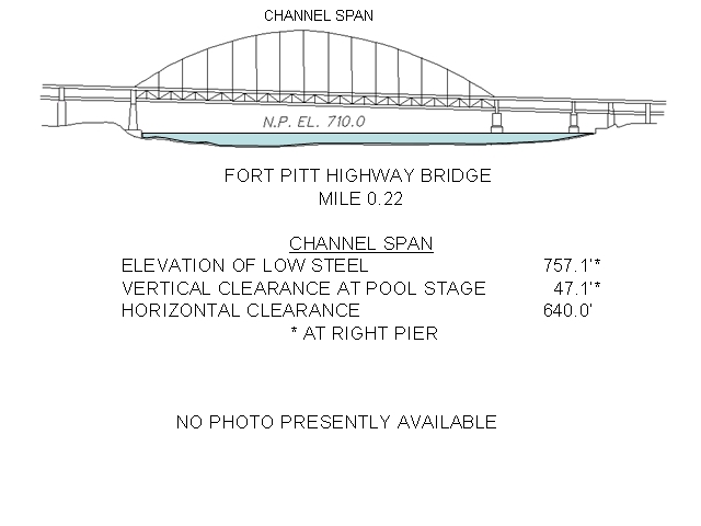
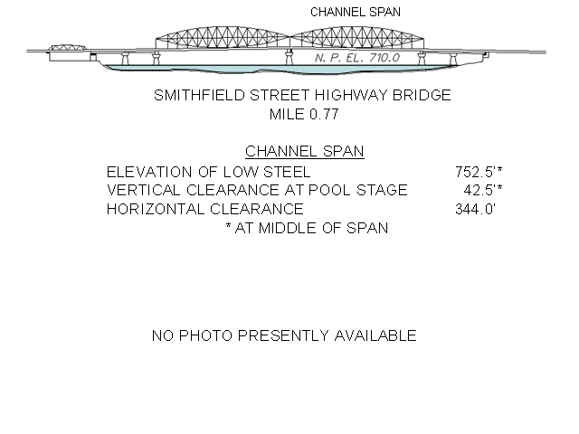
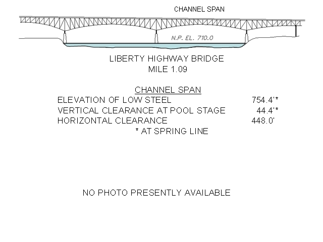
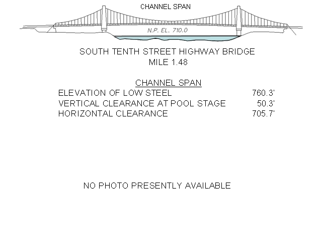
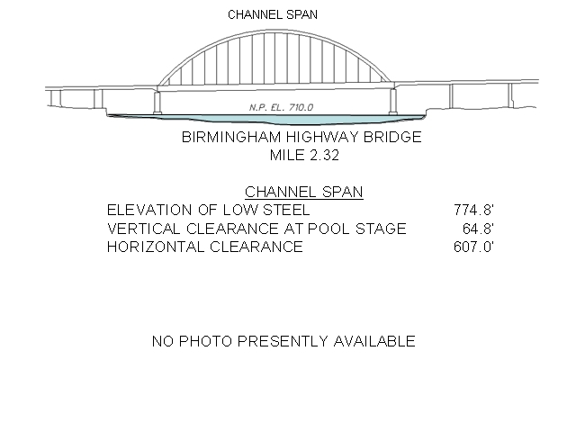
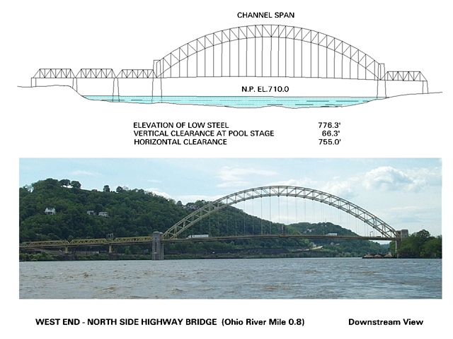
These sketches and photos indicate clearances under the bridges on the rivers around the Point. The vertical clearance is everywhere 40 feet or more. That is ample for any sailboat that is likely to be sailed on the rivers. (I trust no one is planning to sail the Cutty Sark up the rivers?!) There is only one set of side spans in all these bridges that might cause trouble. It is the two small side spans of Port Authority Transit Bridge on the Southern side of the Monongahela River (shown on the left of the sketch linked to below.) They have have a clearance of about 20 feet.
Fort
Duqesne Bridge (46 ft. clearance)
Sixth Street Bridge (Roberto
Clemente) (40 ft. clearance)
Seventh Street Bridge (40.1
ft. clearance)
Ninth Street Bridge("Rachel
Carson") (40.3 ft. clearance)
Norfolk and Southern Railroad
Bridge (40.9 ft. clearance)
Veterans Bridge (51 ft.
clearance)
Sixteenth Street Bridge (41.3
ft. clearance)
Fort Pitt
Bridge (47.1 ft. clearance)
Smithfield Street Bridge (42.5 ft.
clearance)
Port Authority Transit Bridge (43.9
ft. clearance)
Liberty Bridge Bridge (44.4 ft.
clearance)
Tenth Street Bridge (50.3 ft.
clearance)
Birmingham Bridge (64.8 ft.
clearance)
West End Bridge (66.3 ft clearance)
Source of sketches:
Electronic Charting for Navigation, Inland Electronic
Navigation Charts, Army Geospatial Center
Sketches at http://chart.tec.army.mil/ChartServerV2.0/jsp/index.jsp