(for the location of major monuments, see maps included on their individual p.s) Unless otherwise noted, all maps in this section are from
Shepherd, William R. Historical Atlas, (New York: Barnes and Noble, 1929)
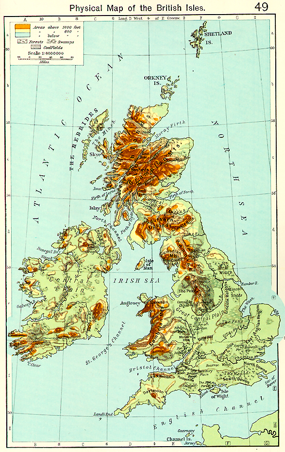
Physical map :Shepherd, p. 49
Roman Britain :Shepherd, p. 51
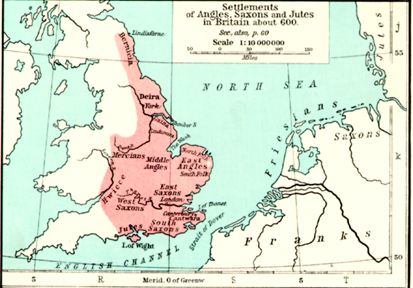
Britain around 600 :Shepherd, p. 51
Britain in the Eighth Century :Shepherd, p. 60
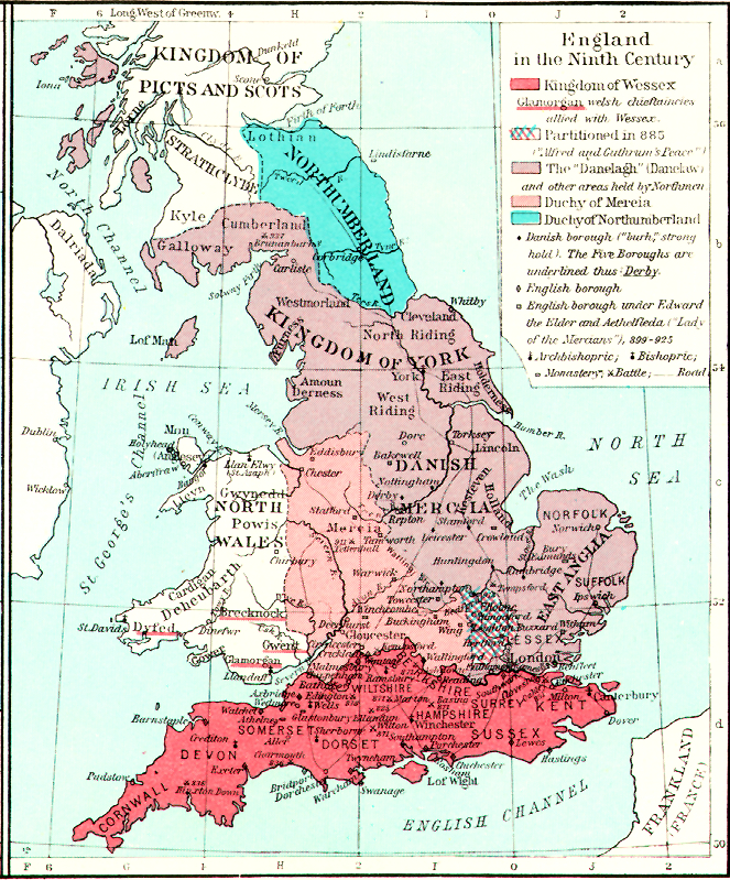
Britain in the Ninth Century :Shepherd, p. 60
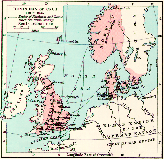
Dominions of King Cnut (1014-1035) :Shepherd, p. 64
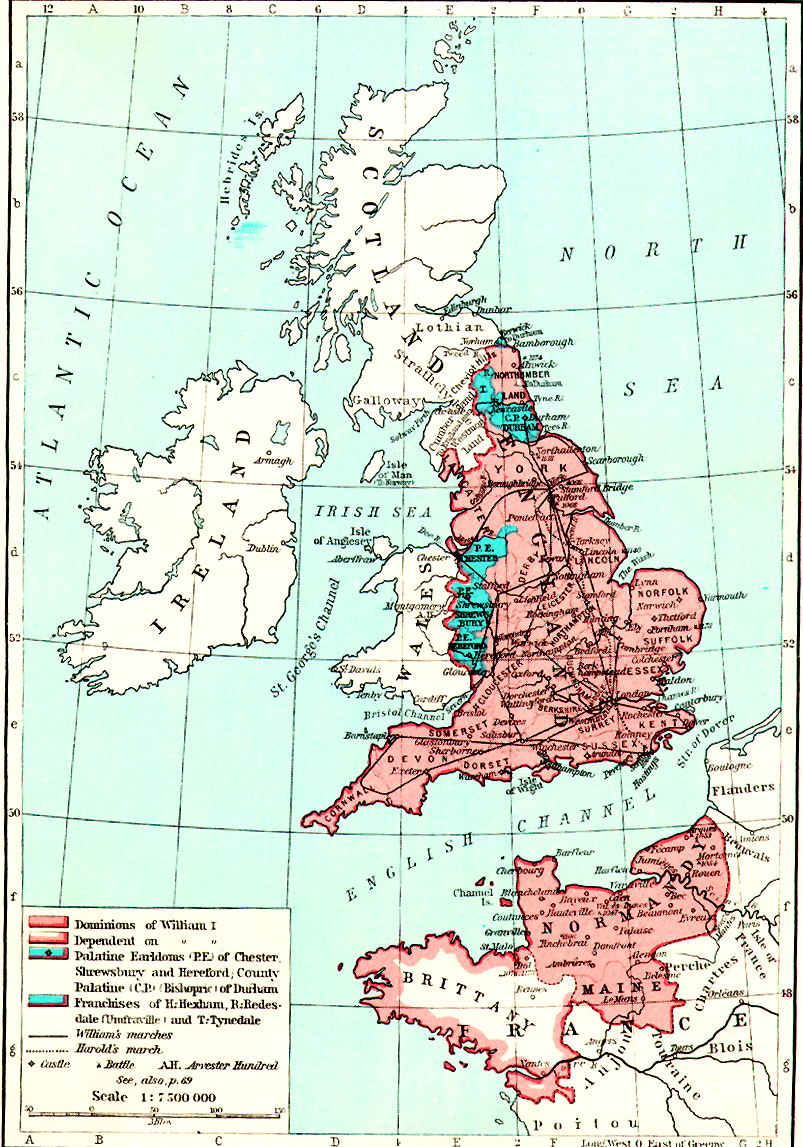
England, 1087-1154 :Shepherd, p. 65
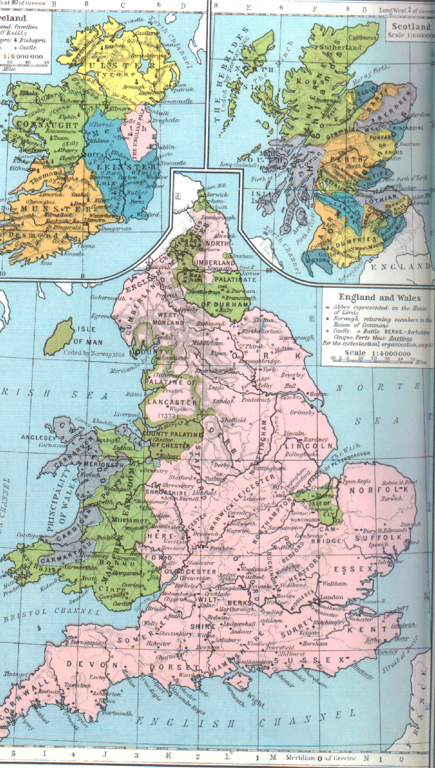
Britain in 1200-1450 :Shepherd, p. 74
Britain in 1455-1494 :Shepherd, p. 84
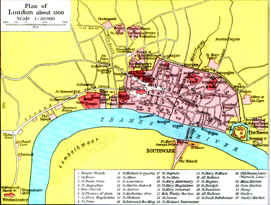
Medieval London :Shepherd, p. 75
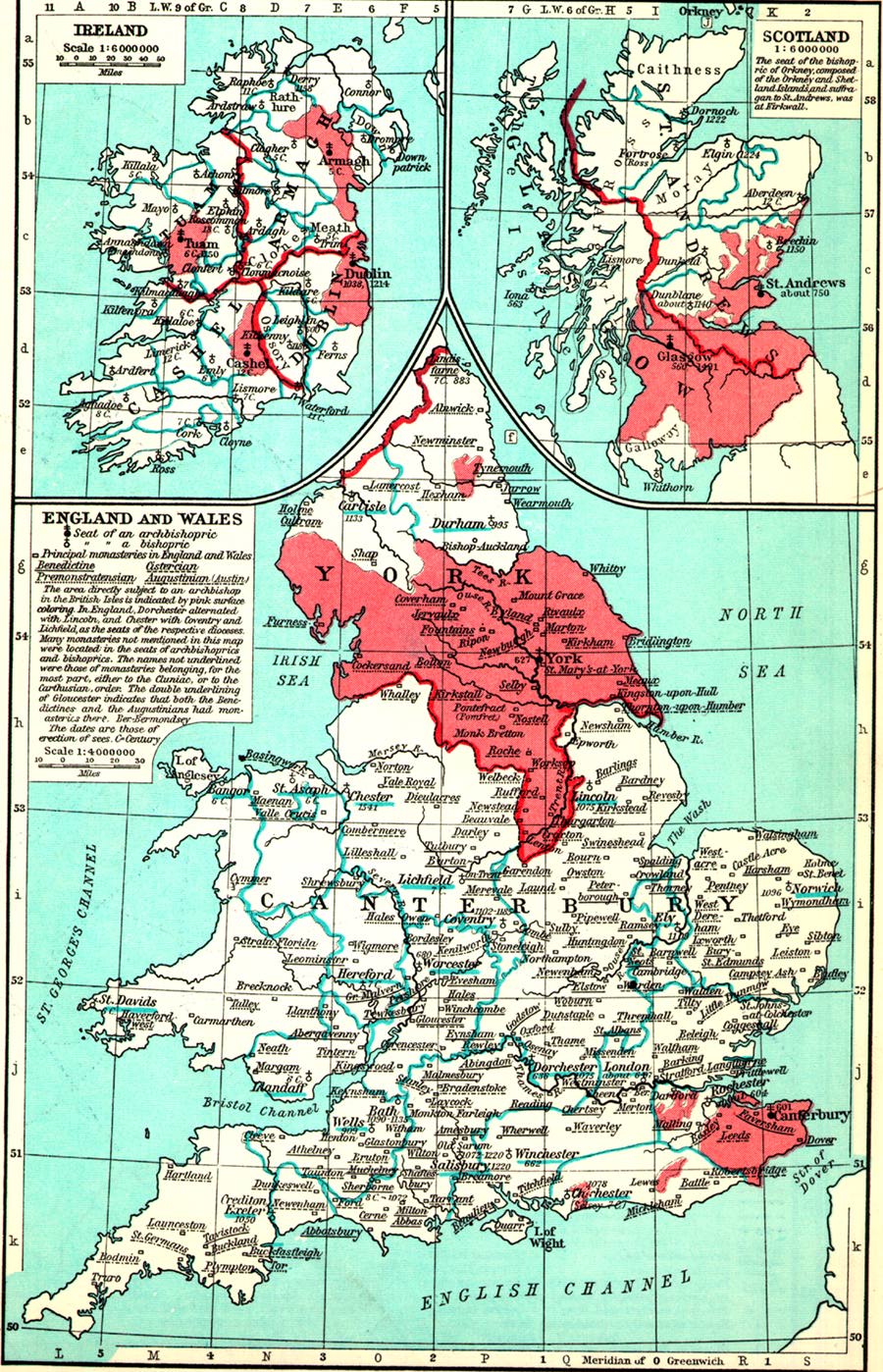
Ecclesiastical Map of the British Isles in the Middle Ages :Shepherd, p. 97
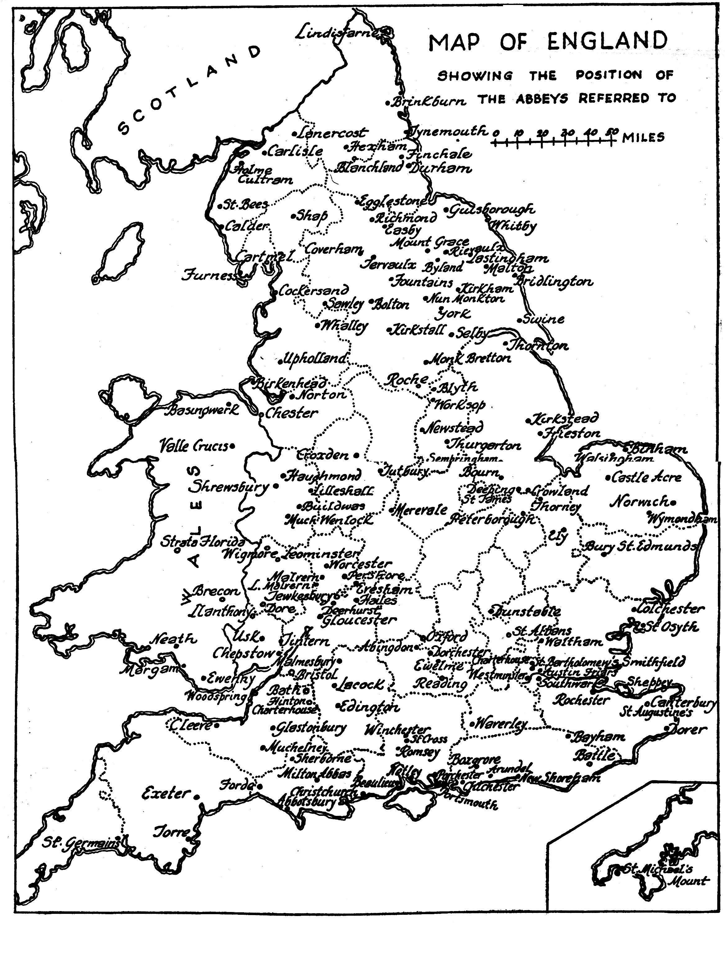
Selected Abbeys :Crossley p. 108
Medieval Commerce :Shephard pp. 98-99
Medieval Universities :Shepherd p. 100
Medieval Industry :Shepherd pp. 102-3
Return to
| |
|
| |
|
Last updated by:JV Date: 06/96