| front |1 |2 |3 |4 |5 |6 |7 |8 |9 |10 |11 |12 |13 |14 |15 |16 |17 |18 |19 |review |
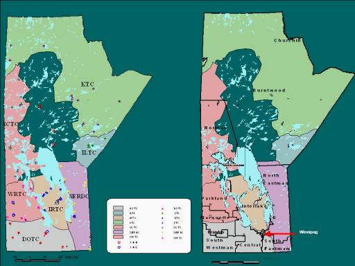 |
The map on the left shows the nine Tribal council (TC) areas - most have geographical boundaries, but the Independent South group is scattered all over (the blue stars) and as such is a virtual geography.
For planning purposes of the TCs, FN communities, and governments, it is important to understand the overlay of the 12 provincial RHAs with the TC areas.
The right-hand map shows the black line boundaries of the 12 RHAs and how the TC areas overlap. In some cases (e.g. Dakota Ojibway TC), the FN communities within that TC are associated with many RHAs (i.e. South Westman, Central, and Marquette). Note: This map was developed by the Health Information and Research Committee of AMC, in conjunction with Mike Anderson (MKO) and Charles Burchill (MCHP) |